Image

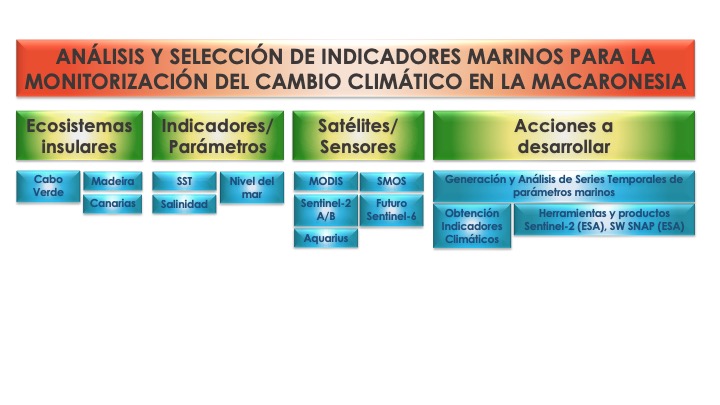
In this context, within the framework of the MACCLIMA project, the Image Processing and Remote Sensing Group (GPIT) of the Instituto de Oceanografía y Cambio Global of the Universidad de Las Palmas de Gran Canaria has worked on establishing the spatio-temporal indicators of climate change on a regional scale. To this end, the analysis and selection of marine indicators for monitoring climate change at a regional level has been carried out, determining: island ecosystems, climate change parameters or indicators, satellites and sensors and the measures or actions to be implemented. In this way, and with the aim of establishing spatial-temporal indicators of climate change on a regional scale, specifically in the Atlantic Archipelagos, the following table has been obtained as a result of the monitoring of specific oceanographic parameters (remote sensing techniques, processing time series of low and medium spatial resolution satellite images and data obtained from surface sensors).